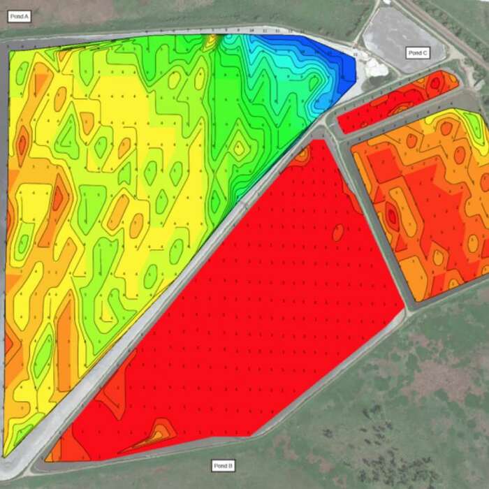
If you operate a noncovered lagoon or pond, you know how important it is to keep it stabilized. Soil naturally erodes into ponds and lagoons over time along with sediment from your process creating a sediment layer. When this material accumulates in your lagoon or pond, it creates a layer of sediment that affects your water quality and your capacity.
At Bristola, we offer sediment mapping services to determine where sediment accumulates in your uncovered pond or lagoon and how much there is. With this data, you can make informed decisions about how to improve your water quality and get your capacity back.

Benefits of Our Sediment Mapping Service
You can use the information collected from our sediment mapping service to anticipate and budget for dredging. Dredging is a necessary practice that removes sediment and organic matter accumulation from the bed of your pond or lagoon. It can be an expensive process that requires planning and budgeting to ensure the best possible outcome.
Knowing how much sediment is in your pond helps you determine when it’ll need dredging services. Periodic sediment mapping also helps you monitor your pond’s infilling rate, allowing you to identify issues, make adjustments and plan for dredging.
Contact Bristola for Sediment Mapping
Bristola provides the sediment mapping services you need to stay on top of your non-covered pond’s or lagoon’s health. Contact us today to learn more.
